Explore
Official NOAA electronic charts — depths, aids to navigation, rocks, wrecks, and contours — over satellite imagery, on your phone. Live
Boating GPS · Marina arrival platform
Navigate on official NOAA charts with your vessel on the map — then let the chart hand off to a detailed arrival view of the marina, docks, and your assigned slip.
The app is live in private beta — runs in your phone's browser, add to Home Screen for the full experience. On-page scenes are annotated where simulated.
How SlipLanding works
Official NOAA electronic charts — depths, aids to navigation, rocks, wrecks, and contours — over satellite imagery, on your phone. Live
Your vessel on the chart with filtered GPS, course, and speed. Waypoints, leg distances, bearings, north-up or heading-up view. Live
Approach a participating marina and the chart hands off to Arrival Mode — docks, slips, and landmarks mapped in detail, your berth highlighted. Signature · live
Signature feature
Charts get you to the harbor. Arrival Mode gets you to the slip. As a boater approaches a participating marina, the map transitions into a detailed orientation view of that marina.
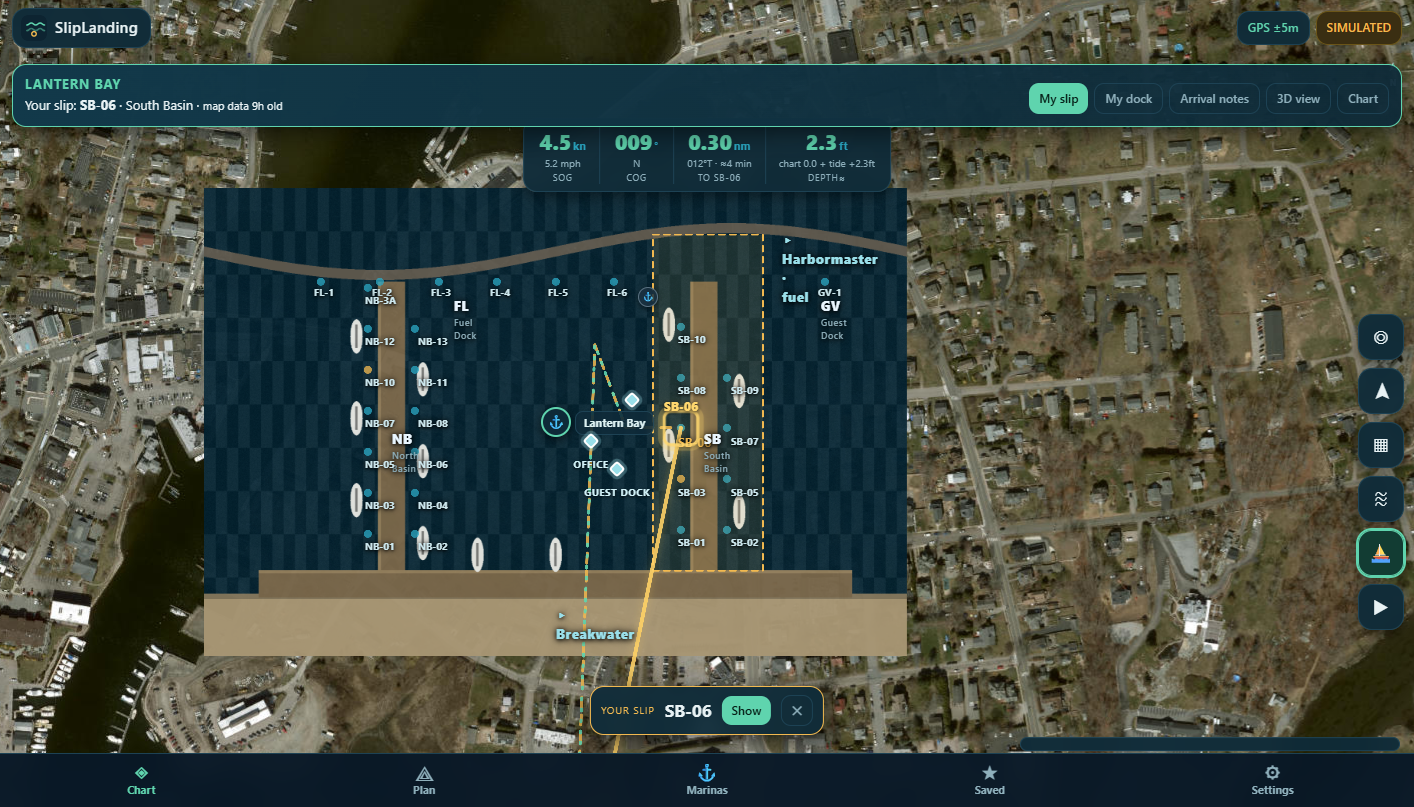
In the app today
Not a landing-page promise — the app is running in private beta. Every feature below exists in the build you can open right now.
Official ENC data — depths, aids, rocks, wrecks, contours — over satellite imagery.
LiveYour vessel on the chart — filtered fix, course, speed, and compass heading where the phone provides it.
LiveTap the arrow and the chart turns to face where you're going — or keep it north-up.
LiveDrop and drag waypoints; nautical miles, bearings, and leg detail as you build.
LiveNOAA CO-OPS measured tides and current predictions, NWS marine forecasts — sourced and labeled.
LiveHarbors along the route — and for participating marinas, the real slip map.
Signature · liveDownload the region before you cast off — integrity-checked, with honest status.
LiveOpt-in GPS recording with replay and GPX/CSV export — built so real trips can be analyzed.
LiveA route planner that checks itself against land, hazards, depth, and clearances — and refuses what it can't support.
ExperimentalAdd to Home Screen from Safari — no app store install needed. Android and desktop browsers work too.
LiveDeliberately off — underway direction ships only after on-water validation and independent review.
RoadmapBoat-network integration is on the roadmap, not claimed today.
RoadmapFor marina operators
Arrival Mode is powered by real marina maps — and the system that makes them exists today. SlipLanding gives marinas a living map of their own facility.
Working today This management platform is operational — it's what our demonstration marinas run on right now.
Talk to us about your marina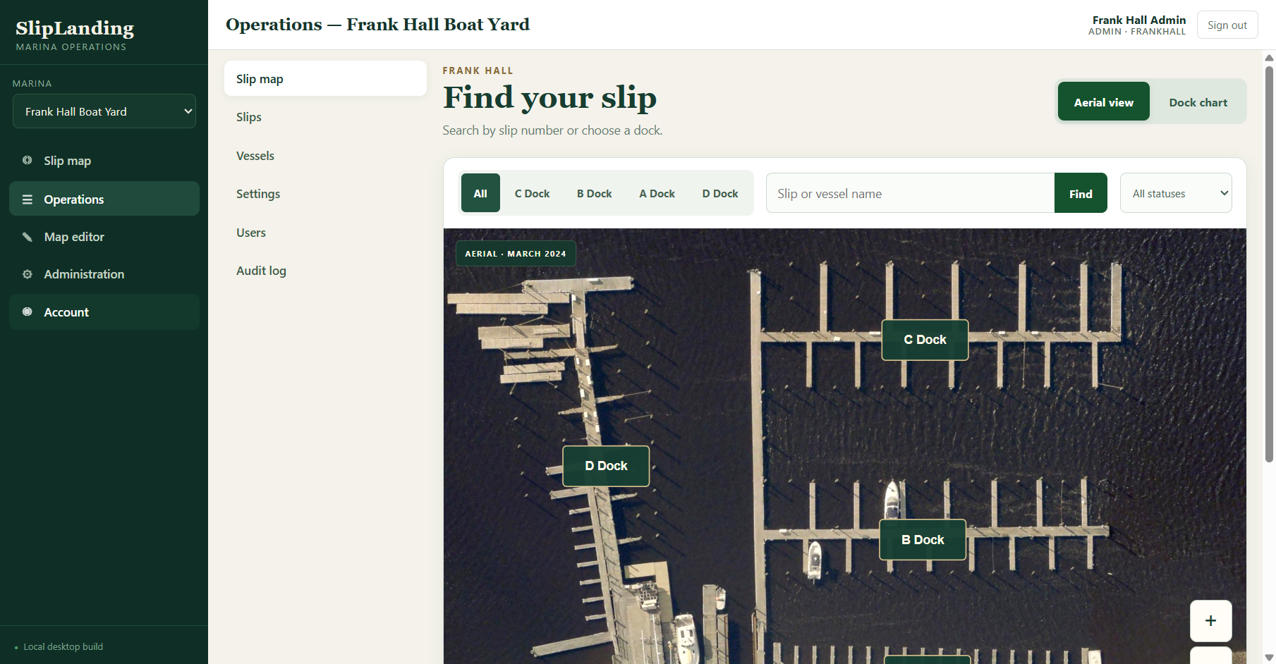
The real app
Switch between the layers of the working product — actual captures from the beta build, on demo marinas.
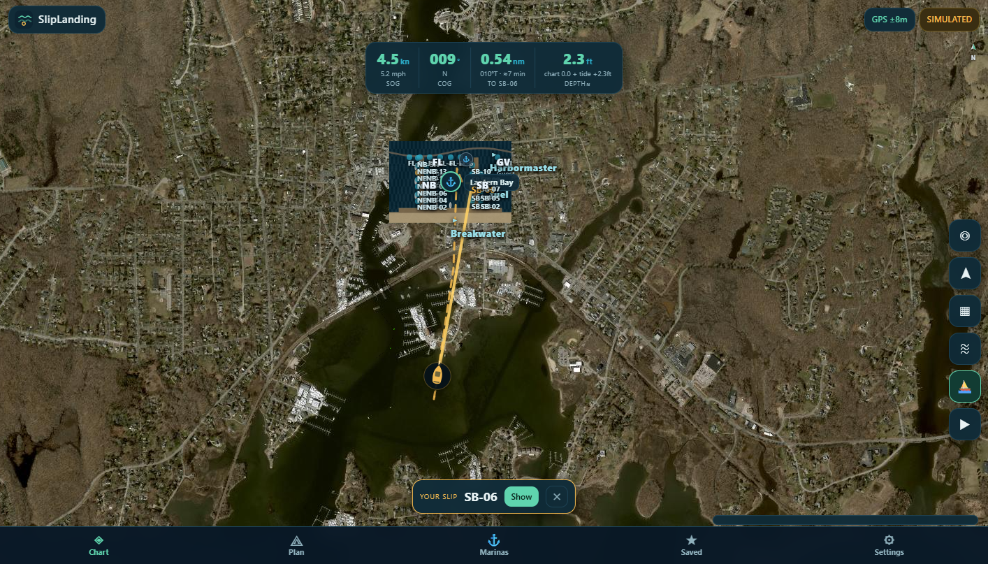
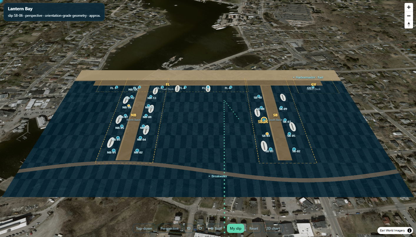
Real app captures on demonstration marinas. Experimental features are labeled as such in the app — not a navigation aid.
Early access
SlipLanding is in private beta — a working app, on the water today. Join the early-access list — boaters get invitations to test the navigation and arrival experience, and marina operators get guided onboarding for their own map.